
*Attend these AOGS2021 Webinars Free! – Registered Attendees Only
All AOGS e-news subscribers are eligible to attend. Please help us forward this information to your friends and
professional contacts. If not yet a subscriber, they need sign up for an account on MARS to receive
the complimentary invite. Not yet a subscriber?
Sign up Here to Receive Your Complimentary Invitation
Axford Lectures | Medal Lectures | Section Distinguished Lectures
All times shown are Singapore Standard Time (GMT+8)
| HS Section Lectures & Meeting | Room: WB1 |
| Transition | 15:30 – 16:00 |
| HS Kamide Lecture | 16:00 – 16:45 |
| HS Distinguished Lecture | 16:45 – 17:30 |
| HS Section Meeting | 17:30 – 18:30 |

Tue-03 Aug, 15:30 – 18:30, Room: WB1
Kamide Lecture - HS (Save a seat)
“Recent advances in global-scale surface water hydrodynamics modelling”
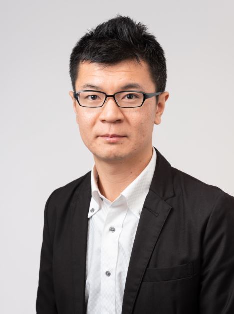
Dai YAMAZAKI
Institute of Industrial Science, The University of Tokyo
Understanding the dynamics of surface waters in rivers and lakes is essential for various science discipline, such as climate and earth system modeling, ecosystem and biodiversity studies, and flood risk management. While many regional-scale studies focusing on specific river basins are very common, global-scale monitoring and prediction of the surface water dynamics (including storage, discharge, water level, inundation extent) had not been achieved for a long time.
This is because: 1) The surface water dynamics is usually a closed system within each river basin, and generalization of local information to larger-domain is not straightforward compared to atmosphere and ocean dynamics which are spatially-continuous; 2) The dynamics of surface water is governed by detailed local topography which are much smaller than the typical resolution of global-scale analysis, thus is difficult to directly handle either by numerical modelling and remote sensing.
In order to simulate the surface water dynamics at a global-scale, I have developed the global river hydrodynamic model “CaMa-Flood” which simultaneously represents large-scale water balance and small-scale floodplain inundation dynamics by treating detailed topography as sub-grid parameters. While water budget is calculated along the river network at a typical global modelling resolution (10-100 km grid-size), CaMa-Flood simulates the spatial and temporal variations of water level and inundation extent based on 90-m resolution satellite topography data. This multi-scale modelling approach is computationally very efficient, and large-scale flood simulation becomes at least 10,000 times faster compared to conventional 2D flood models while the accuracy of simulated hydrodynamics is kept at similar levels. Achievement of the efficient and accurate hydrodynamic simulations expanded the range of possible applications of global river models; and CaMa-Flood is now used for multiple purposes including global flood risk assessment, real-time ensemble flood hazard forecast, global estimate of methane emission from wetlands.
After developing basic schemes for large-scale surface water dynamics, I realized the quality of baseline topography data is the bottleneck for more accurate flood simulations. For example, spaceborne digital elevation model (DEM) contains various errors which are not negligible for the realistic calculations of surface water dynamics. In these five years, I have developed several global high-accuracy topography maps which are used as baseline data for global flood models. The major research product is “MERIT DEM” which was developed by removing four different error components from existing DEM by combining multiple satellite data and multiple filtering techniques. Also, global hydrography map named “MERIT Hydro” was developed by combining MERIT DEM and various water layer data including global Landsat analysis and OpenStreetMap. Implementation of these high-accuracy topography maps significantly improved the accuracy of CaMa-Flood simulation, and now direct comparison of water stage (flood extent & water surface elevations) against satellite measurements is achieved. Furthermore, these topography maps which were primary developed for flood modelling are now widely used as fundamental data for many different research fields.
In AOGS talk, I will review the history of CaMa-Flood and its baseline dataset development. I will also discuss the future perspectives of global surface water studies considering the advantage of these recent developments in modelling studies, including the very latest activities on model-satellite integration.
Biography
Dai Yamazaki Ph.D. is an associate professor at Institute of Industrial Science, The University of Tokyo, Japan. After getting Ph.D. in Civil Engineering from The University of Tokyo in 2012, he was based at University of Bristol, UK (2012-2014) and Japan Agency for Marine-Earth Science and Technology (JAMSTEC; 2014-2017). He has been working on the development of a global-scale river hydrodynamics model, focusing on how to simultaneously represent the continental-scale water balance and local-scale flood dynamics. The “CaMa-Flood” global river model developed by Dr. Yamazaki and his colleagues is now widely used for earth system modelling and global flood risk studies by many research teams in the world. He also made significant contributions to the development of high-quality global hydro-topography maps which are used as baseline data for earth science. His major outcomes, named MERIT DEM & MERIT Hydro, are publicly available for research & education purposes, and he has provided the datasets to more than 1500 scientists for collaborative researches such as on flood simulations, land hydrology modelling, and hydro-bio-geochemistry. By combining his high-quality topography maps and global river hydrodynamics model, the simulation accuracy of global surface water dynamics was significantly improved. He is currently working on the integration of remote sensing of surface waters into global river modeling. He academic contribution was honored with multiple awards, including “JSPS Ikushi Prize” (2012) and “The Commendation for Science and Technology by the Japan Minister of Education, Culture, Sports, Science and Technology” (2019).